
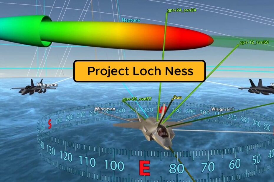
What is Project Loch Ness?
Project Loch Ness is a free initiative by Ansys seeking to provide users with a detailed library (or data lake) of synthetic aperture radar (SAR) training data. This dataset has been developed to enable the training and validation of user’s AI/ML models for ground-based target detection scenarios.
SAR imagery can often be complex to decipher, yet the technology presents distinct benefits over traditional optical sensors. The applicability of this tech includes applications in scientific remote sensing, such as asteroid detection and characterisation, through to defence and security use cases. Satellite Operators, developers, engineers and other users are looking towards AI for a solution that can reliably interpret massive amounts of data from complex SAR scenes. However, these AI tools require extensive training libraries to ensure their accuracy at identifying targets, particularly in noisy environments.
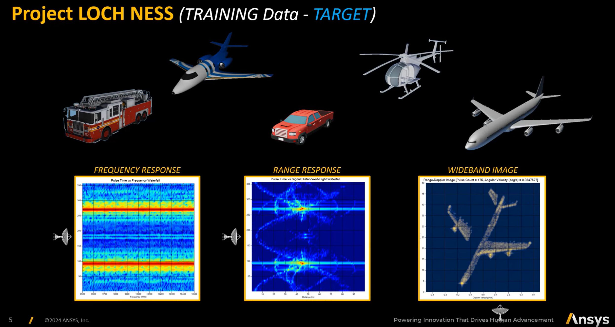
Various Target Objects in the Loch Ness Dataset [1]
How has this data been generated?
Whilst real-world SAR imagery requires state-of-the-art equipment, and expensive test flights potentially at risk of unwanted external observation, the dataset behind Project Loch Ness has been generated using the new Ansys RF Channel Modeler (RFCM) Solution. This cutting-edge tool allows RF engineers to simulate physics accurate, multi-domain systems and generate extensive SAR and ISAR libraries from their scenes.
In this particular instance, the dataset focuses on a variety of ground-based targets, however RFCM allows for the rapid design and generation of synthetic datasets across any number of SAR or ISAR configurations. Ground, air or space based sensors can all be simulated, as well as any combination of target objects, trajectories, background noise, etc. Ultimately, this facilitates an incredibly adaptable workflow well suited to the generation of large custom training libraries, allowing users to include their own proprietary models, sensors, trajectories, etc. All in a physics accurate multi-domain environment.
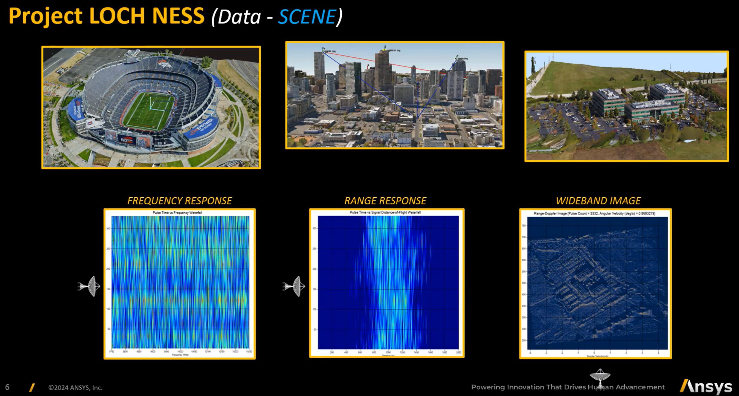
Various Background Scenes in the Loch Ness Dataset [1]
How can I access this data?
To access this free dataset, as well as detailed material explaining the data structure and content, head to the following link to register:
RF Channel Modeler
For more information on RF Channel Modeler and its SAR capabilities, check out the video below, or reach out to us with any questions.
RF Channel Modeler also provides industry leading, GPU enabled capabilities to simulate high-fidelity Wireless Telecommunications systems. The tool allows for the simulation of highly complex 5G and 6G communications amongst dense urban environments, accounting for local terrain and structures, multi-path and diffraction effects, beamforming and more. For more information, please reach out to us at Leap Australia.
RF Channel Modeler SAR Capabilities [2]
[1] Ansys, “Project Loch Ness,” 2025. [Online]. Available: https://www.ansys.com/campaigns/project-loch-ness. [Accessed 1 16 2025].
[2] Ansys, “RF Channel Modeler,” 2025. [Online]. Available: https://www.ansys.com/products/missions/ansys-rf-channel-modeler. [Accessed 1 16 2025].