In the world of satellites, there’s a new game-changer: Low Earth Orbit (LEO) constellations joining hands with Global Navigation Satellite Systems (GNSS). What does this mean for us? Well, it’s all about making navigation, positioning, and timing (PNT) better than ever before. GNSS encounter numerous challenges when operating in critical environments, such as densely populated urban infrastructure, areas with dense foliage, and indoor spaces. But with LEO-PNT systems stepping in, these challenges become opportunities for innovation and advancement, ensuring seamless navigation experiences wherever we go.
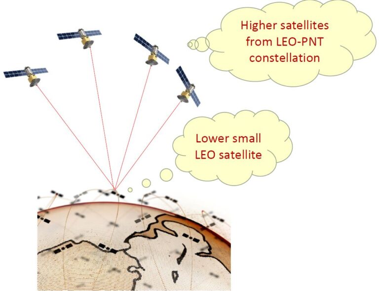
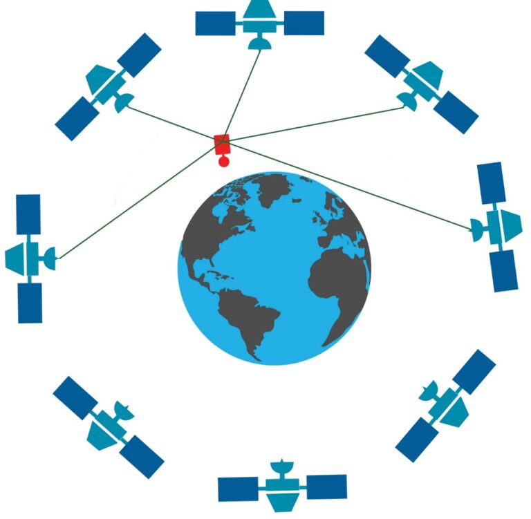
Imagine a scenario where a tiny CubeSat, no larger than a shoebox, orbits Earth at 500 kilometres above our heads. Now, picture this CubeSat receiving navigation signals not just from one, but from a constellation of upper LEO satellites. Sounds futuristic, doesn’t it? Well, that’s precisely what we’re simulating in our research. Now, imagine we can pinpoint their exact positions with high accuracy, even among the chaos of a crowded LEO. That’s where LEO-PNT systems come in.
Our recent studies took a deep dive into this tech wonderland. We figured out a clever trick: using signals from higher LEO satellites to track the paths of lower ones. It’s like having a backup plan in space – making sure we always know where our satellites are, even when things get busy up there.
But how do we even begin to study these systems, especially when they don’t yet exist in real life (at least at the moment)? The first step in our study involved simulating a LEO-PNT system using Systems Tool Kit (STK) software. With STK, we could create a virtual constellation comprising 240 satellites orbiting at an altitude of 1000 km in a near-polar orbit, denoted by the Walker-delta pattern 85.64°: 240/12/6.
This virtual setup allowed us to explore and understand how these systems might work in the real world. For instance, let’s take a 3U-CubeSat flying at an altitude of 500 km. From our simulated constellation, this CubeSat would have access to signals from approximately 19 to 59 satellites. Now, imagine each of these satellites is broadcasting navigation signals.

That means our little CubeSat would have a plethora of signals to track, ensuring robust and reliable navigation capabilities. With such abundant satellite coverage, our CubeSat can confidently navigate through space, making its mission a success.
In our simulations, we’re replicating the navigation signals transmitted by this upper LEO-PNT system down to the CubeSat. It’s like crafting a virtual map in space and ensuring our CubeSat has access to the complimentary navigation guidance. Why do we bother with these simulations, you might ask? The answer is simple: to see how well these signals help our tiny CubeSat navigate through the vastness of space. By mimicking real-world conditions and interactions, we’re uncovering just how effective these signals are in guiding our satellite safely on its journey.

We employ sophisticated methods to estimate the CubeSat’s orbit using simulated observations. Then, we compare it with a reference orbit to highlight the advantages of LEO-PNT Systems in this case. Upon comparison with the reference orbits, the kinematic Precise Orbit Determination (POD) relying solely on LEO-PNT observations demonstrates impressive accuracy. The root mean squared error (RMSE) values are consistently better than 15 cm across the three orbital components, with a 3D RMSE of around 22 cm, as detailed in Table 3. Interestingly, only 3% of this comparative analysis shows values exceeding 1 meter compared to the reference orbits. This level of accuracy highlights the reliability and precision of LEO-PNT observations in determining satellite orbits, paving the way for enhanced navigation and positioning capabilities in space.
But why do we need all this? Simple: because our world relies on satellites for so much! From guiding planes in the sky to helping us navigate on the ground, satellites are the unsung heroes of modern life. And with LEO-PNT systems, we’re making sure they’re even more reliable and precise than ever.
For more details about this study and related research, check out our paper: https://doi.org/10.33012/2024.19485
I am Dr. Amir Allahvirdizadeh, a Research Fellow at Curtin University. Let’s connect on LinkedIn to stay updated on my work and other relevant studies.


